Map of the Volp caves

Image ID / File Name
fig_01_plan_musee_cmyk_fogra39-1536x606.png
Title
Map of the Volp caves
Image Creation
Author
Marcel Henry
Robert Bégouën
François Rouzaud
Andreas Pastoors
Éric Bégouën
Jörg Hansen
Gilles Tosello
Rights
Rightholder (Person)
Andreas Pastoors
Licence
CC BY-SA 4.0
Note / Reference

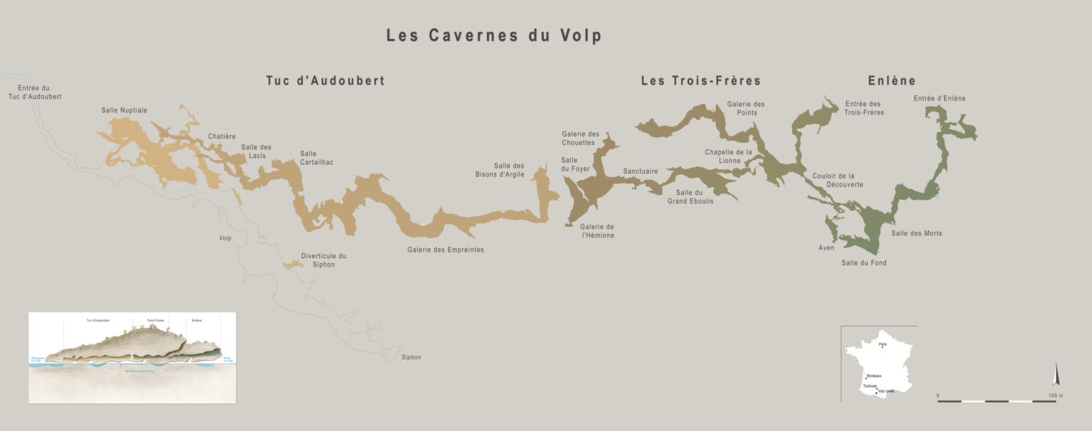
Allgemeine Topografie der drei Volp-Höhlen nach Marcel Henry und Robert Bégouën (1968), François Rouzaud (1976), Andreas Pastoors und Éric Bégouën (1998) und Jörg Hansen (2009) und ihre jeweilige Lage innerhalb des Kalksteinmassivs (Zeichnung Gilles Tosello); Quelle